Advanced Global-Local forecast at a glance:
A stunning Eye-catcher
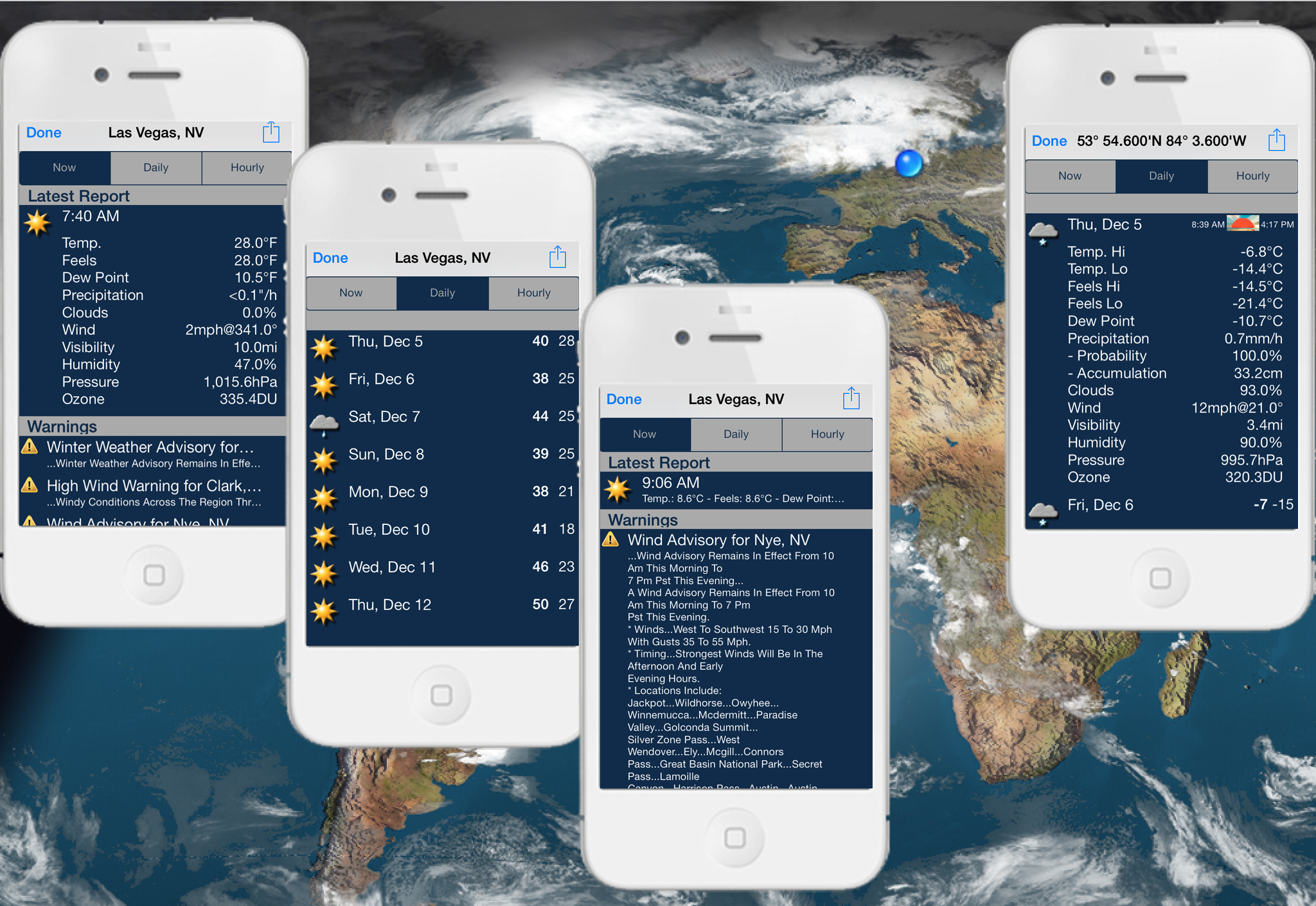
Available with WeatherTrack version 1.5.6. This feature offers some important extra data (optional in-app purchase). Data like the all-important “feels like” temperature, highs and lows for the day is also provided along with dew point, clouds, humidity, visibility, pressure, ozone and precipitation. Even the probability and expected amount of rain or snow is given when applicable. The essential wind direction and speed is also included.
All data are presented nice and clear. You can easily switch between a 7-day weather forecast, current conditions and a guide to the weather across the hours of the current day. Choose between the overview or the detailed forecast.
Weather warnings are also provided for any location in North America.

Worldwide storm warnings or strong winds are indicated as well.
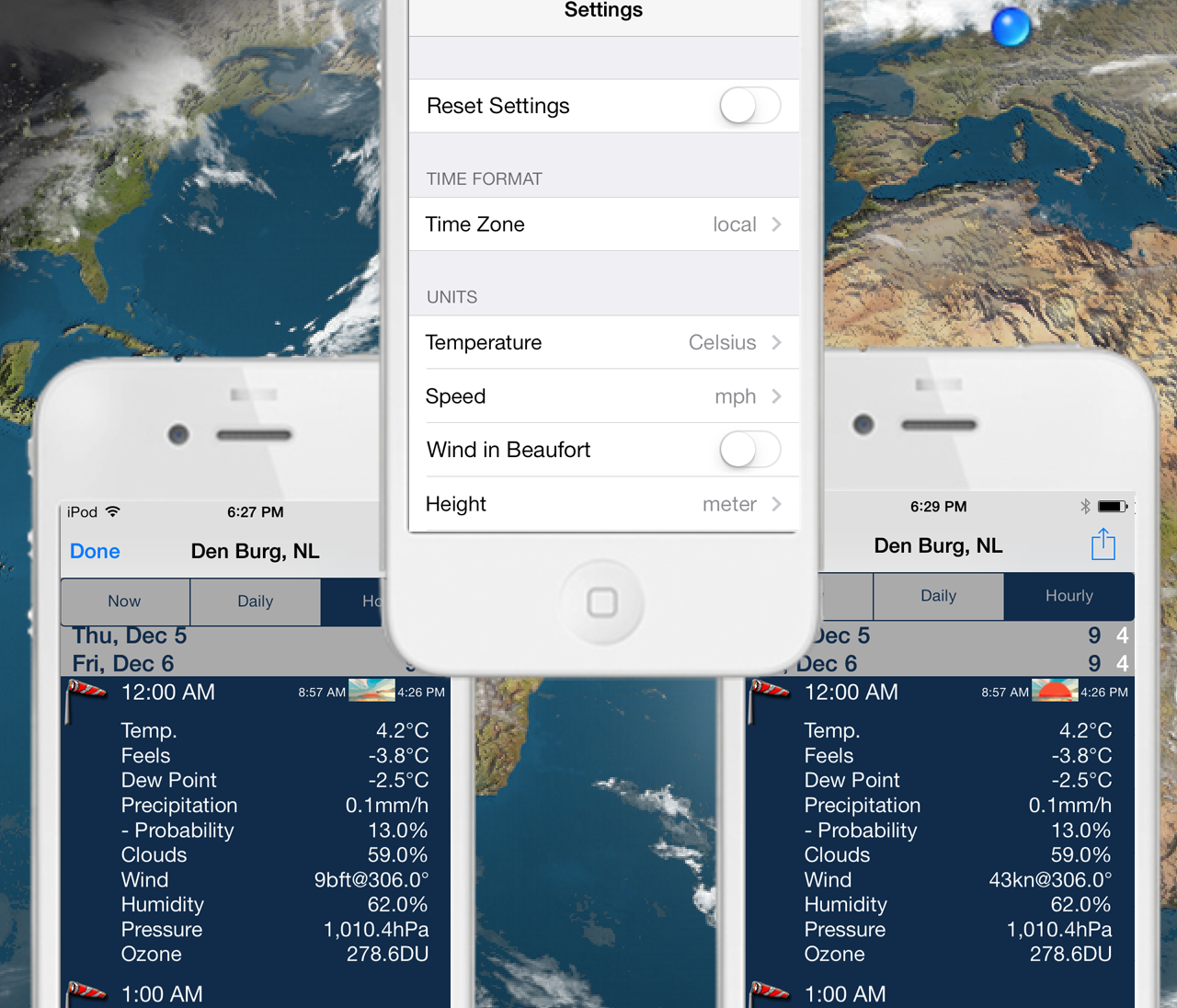
Temperatures can be viewed in either Fahrenheit or Celsisus and distances measured in Miles or Kilometers.
Wind speed can be viewed in either knots or beaufort, mph, m/s or km/h.


Enjoy a fascinating view from space showing our planet Earth with its worldwide clouds systems. Explore Global Weather's spectacular meteorological snapshot. Watch weather situations as they unfold around the world. A world-wide cloud formation view is available that refreshes every three hours.
This is a unique, interactive, easy to use feature for anywhere-weather on the go. Just tap the map anywhere in the world to get the weather instantly. That's all you need to do to get a forecast! The perfect tool for travelers.
To use this feature, you must be online. The data for the worldwide cloud formation will be updated every three hours. Regardless of the cloud update the daylight area is calculated every 10 minutes, by shifting slowly the shadow of the night.
You can tap anywhere on the screen and see a bubble pop up with the local forecast at exactly this position.
Local weather can be displayed for any location world wide, and is by default presented for the current GPS position. Up to twenty locations with local weather information can be added by touching the screen at the corresponding position.
A seven day forecast with weather information such as condition description for wind (direction, speed), temperature, rain, humidity, clouds, fog, pressure will be displayed. This includes sunset and sunrise information.
The positions of these bubbles (up to 10) are remembered, so you will see the weather in your favorite places all around the world every time Global-Local launches.
World clock. Analog and digital time is displayed in the WeatherTrack bubble. It can be turned on and off in settings.
City search. Find a specific location by entering the city/town name. Any city/town worldwide with a minimum of 1000 inhabitants can be searched directly in Global-Local.
Airport search: Find any airport worldwide by ICAO, IATA code or name, or nearby, referring to a 1 degree circle around your current position.
Magnifier. In case, you've forgotten your reading glasses, the magnifier function helps you. Just keep your finger a second on the screen until a magnifying circle pops up. The magnifier displays a crosshair and makes it easier to exactly place the information bubble. When you release the screen, the bubble pops up.
Customer configuration for Global-Local. The transparency of the bubble, the pointing arrow as well as the cloud shading are configurable.
This Global-Local feature is quite useful as you can see the global systems and how they move around on Earth. Additionally you can tap anywhere on the map and see a bubble pop up with the local forecast at exactly this position.
Patience required. Actually, WeatherTrack is able to display way more than only 20 bubbles. However, this would require quite some patience from the user. The more bubbles are opened the more time consuming the download. Therefore the number is limited to a total of 20 bubbles. It also takes a little while to update the current cloud data and sun position- depending on the quality of the internet connection and the speed of the device being used.
Image or Calculation? Daylight area respectively the sun position with shading and relief (landform calculation) are calculated from WeatherTrack. Only clouds are overlayed using different satellite images.
Global-Local forecasts different to GRIB forecasts? Global-Local data are based on weather forecasts provided by the Norwegian Meteorological Institute. These data might sometimes be different compared to GRIB files forecasts as GRIB data use different weather models from different providers.
Local time and UTC. WeatherTrack offers two different options to display time - either in UTC or in local time as those settings in the iPhone/iPad/iPod touch. Similar, time for Global-Local forecasts is displayed in UTC or local time.
Global-Local view can be zoomed by factor 4.
Share GLOBAL-LOCAL weather forecasts via email, Twitter, Facebook etc.
Date of the cloud image displayed (bottom, right corner) (user's request)
(Important! In order to avoid mobile data fees, the loading of the clouds is turned off by default, unless the device is connected via wifi. If you want to use this function despite incurring mobile data fees, it must be activated in the settings.)


